News dated
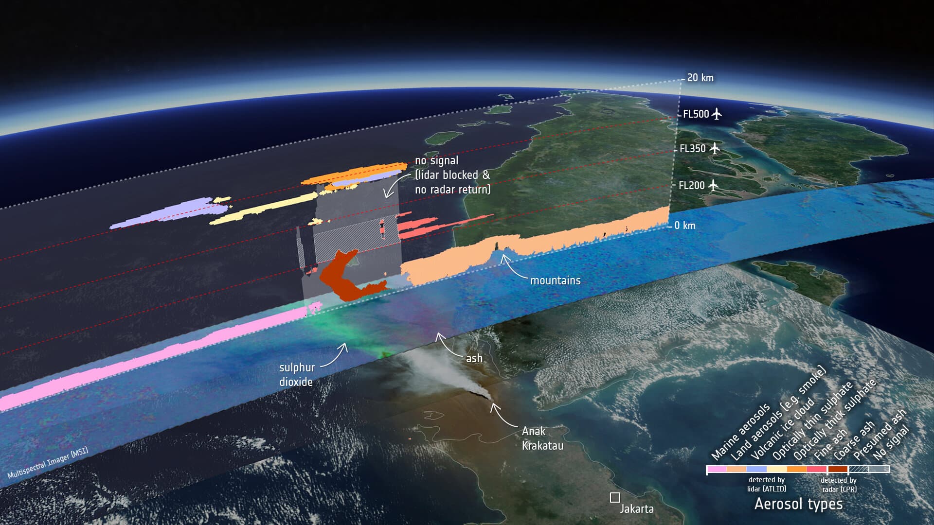
On 1 October, ESA described how EarthCARE data were used during the eruption of Anak Krakatau, which began on 4 September in Indonesia. The Darwin Volcanic Ash Advisory Centre used the satellite’s lidar to check the plume’s altitude and inform aviation advice. [1]
Lidar sends pulses of light and measures the signal returning to the instrument, building vertical profiles of the atmosphere. The contents of some observed layers remain uncertain; a region with no signal does not mean air that is definitely free of ash. [2][1]
The bright side
A satellite designed to study clouds and aerosols is also providing measurements useful for aviation safety advice. [1]
One idea, in simple words
A plume is a cloud of material rising from a volcano. People advising aircraft need to know where it is. On 1 October, ESA explained how EarthCARE helped study the plume from Anak Krakatau in Indonesia after its eruption began in September. The satellite carries a lidar, an instrument that sends light into the atmosphere and measures the light returning. This helps it read layers at different heights. Imagine a building seen from above: knowing its position does not tell you how many floors it has. This is an example from our editors to explain why height matters. Some layers remain uncertain. An area without a signal is not automatically safe. [2][1]
A little discovery to keep
What did you discover?
Straight from the source.
- EarthCARE’s view of volcanic plume boosts air safety European Space Agency · 1 Oct 2026
- EarthCARE’s atmospheric lidar European Space Agency · No publication date provided
- EarthCARE distinguishes volcanic aerosols European Space Agency · 1 Oct 2026
Original reporting summaries prepared with AI assistance and accessible sources. Our editorial method.