News dated
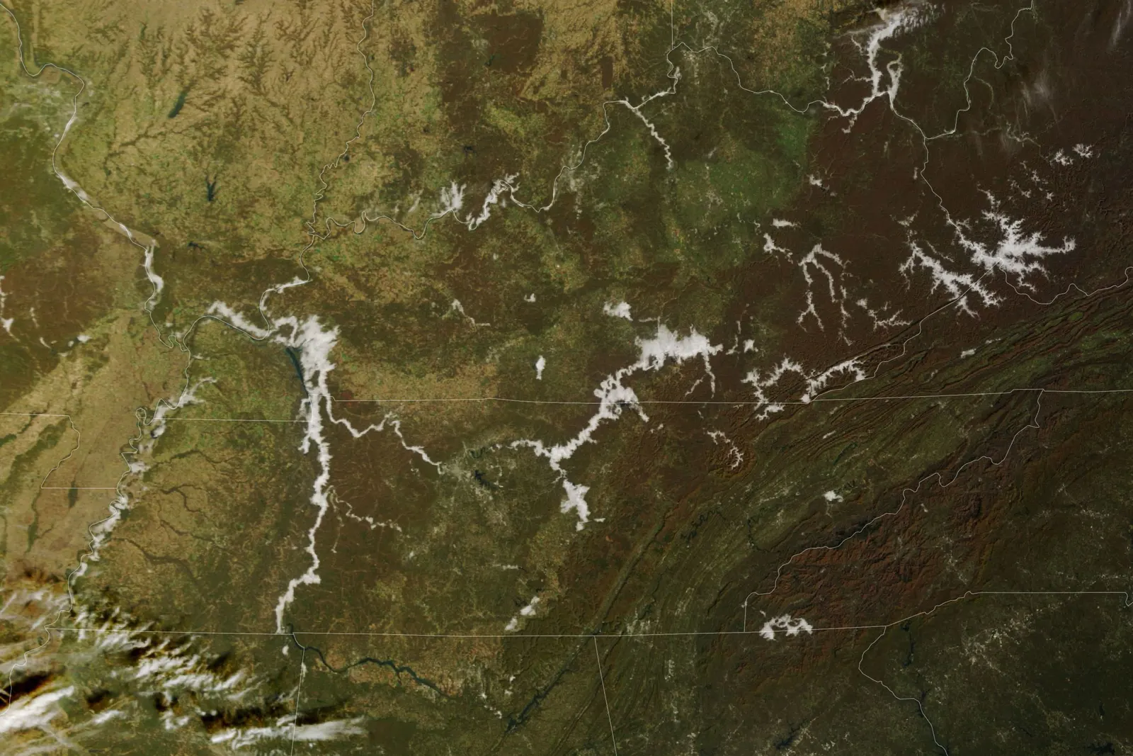
An image acquired by Terra on the morning of 8 November shows branching white streaks in valleys of the Appalachian Plateau and along the Cumberland River. In its account published on 10 November, NASA Earth Observatory explains that these low clouds appear to be fog. They are no longer visible in afternoon images from the same day. [1]
The phenomenon helps reveal the landscape: during long autumn nights, the ground loses heat and cools nearby air. When the dew point is reached, water vapour can condense into tiny droplets. Colder air tends to flow downhill and collect in valleys, while waterways supply moisture. This explains the process; it is not a direct measurement of every valley pictured. [1][2]
The bright side
The public images provide a concrete way to understand the interaction between the atmosphere and the shape of the land. [1][2]
One idea, in simple words
On 10 November, NASA published images taken two days earlier over part of the United States. In the morning, white streaks marked some Appalachian valleys. NASA says these low clouds appear to be fog. They were no longer visible in afternoon images. Fog is a cloud touching the ground. It can form when air close to the surface cools enough for water vapour to become many tiny droplets. Cold air tends to gather in valleys, where rivers can supply more moisture. Imagine a map on which white follows the low places: it is one way to read the landscape. The photograph does not, however, measure the conditions in every individual valley. [1][2]
A little discovery to keep
What did you discover?
Straight from the source.
- Autumn Mornings Bring Valley Fog NASA Earth Observatory · 10 Nov 2026
- What’s the Difference Between Fog and Clouds? NOAA NESDIS · 2 Sept 2025
Original reporting summaries prepared with AI assistance and accessible sources. Our editorial method.