News dated
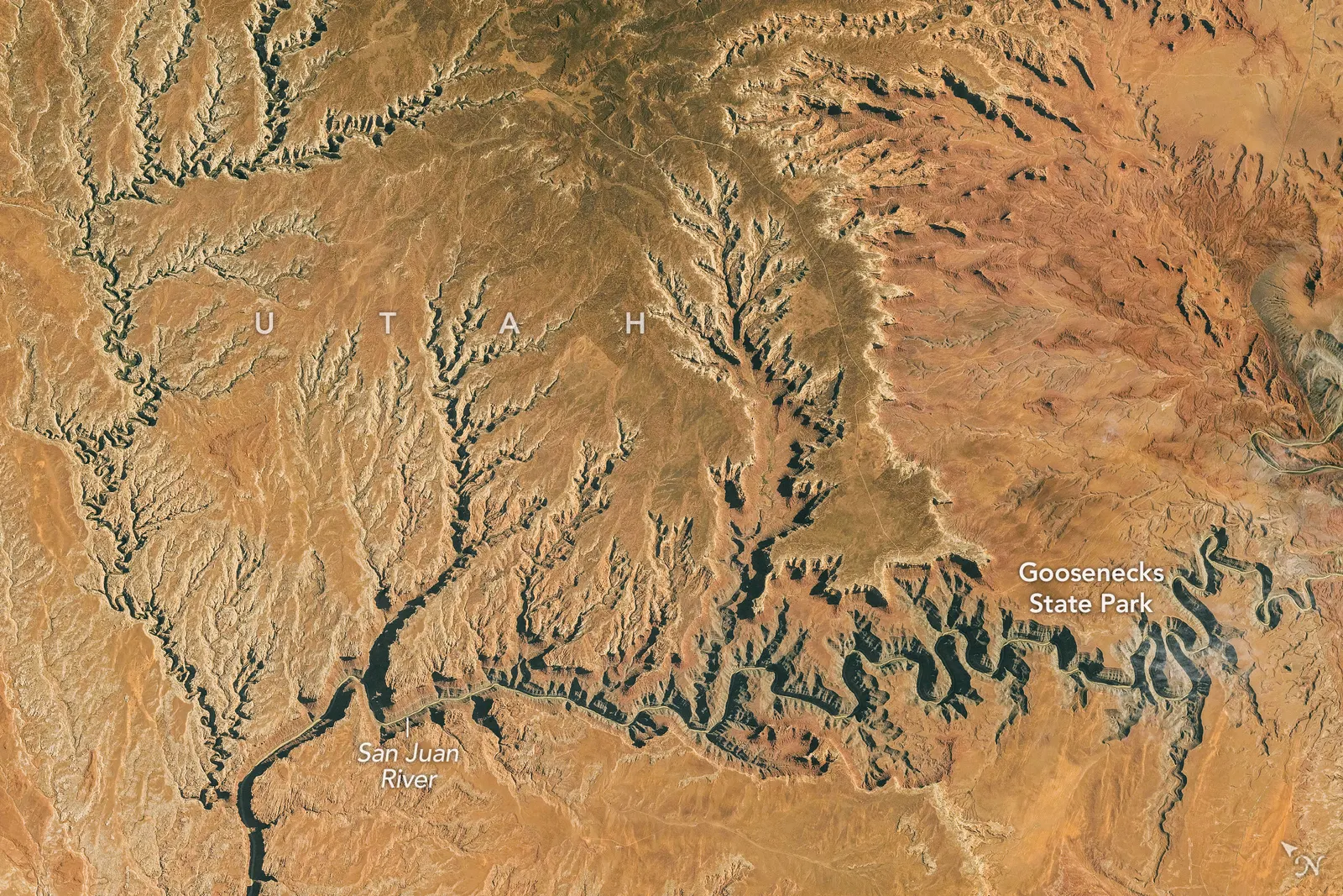
On 6 November, NASA Earth Observatory published a photograph of the San Juan River’s Goosenecks in Utah, taken from the International Space Station on 6 October 2026. The view shows the river’s deeply incised bends. The news is the image’s publication, not the discovery of the canyons. [1]
The Utah Geological Survey’s explanation separates two stages: the river formed its bends across relatively flat ground; later regional uplift encouraged it to cut its course deeper into rock. The loops remained as the channel deepened. This is not a river that suddenly decided to take a longer route. [2]
The bright side
A public photograph offers a useful viewpoint for connecting landscape forms with geological history. [1]
One idea, in simple words
NASA published a photograph of large bends in the San Juan River in the United States on 6 November. The image was taken from the International Space Station on 6 October. These dates mean different things: when the photograph was taken and when it was published. River bends are called meanders. The ones in the image were already known, so this is not the discovery of a new river. [1]
The Utah Geological Survey explains that the river formed its bends across gently sloping land. As the region rose, the water cut deeper while keeping its loops. To picture the shape, imagine a curved line being carved deeper and deeper. That is an example to help explain the form, not an experiment recreating its entire history. [2]
A little discovery to keep
What did you discover?
Straight from the source.
- Taking a Gander at Utah’s Goosenecks NASA Earth Observatory · 6 Nov 2026
- GeoSights: The Goosenecks of the San Juan River, San Juan County, Utah Utah Geological Survey · No publication date provided
Original reporting summaries prepared with AI assistance and accessible sources. Our editorial method.